Meandering up a long river trip to the nation’s capital
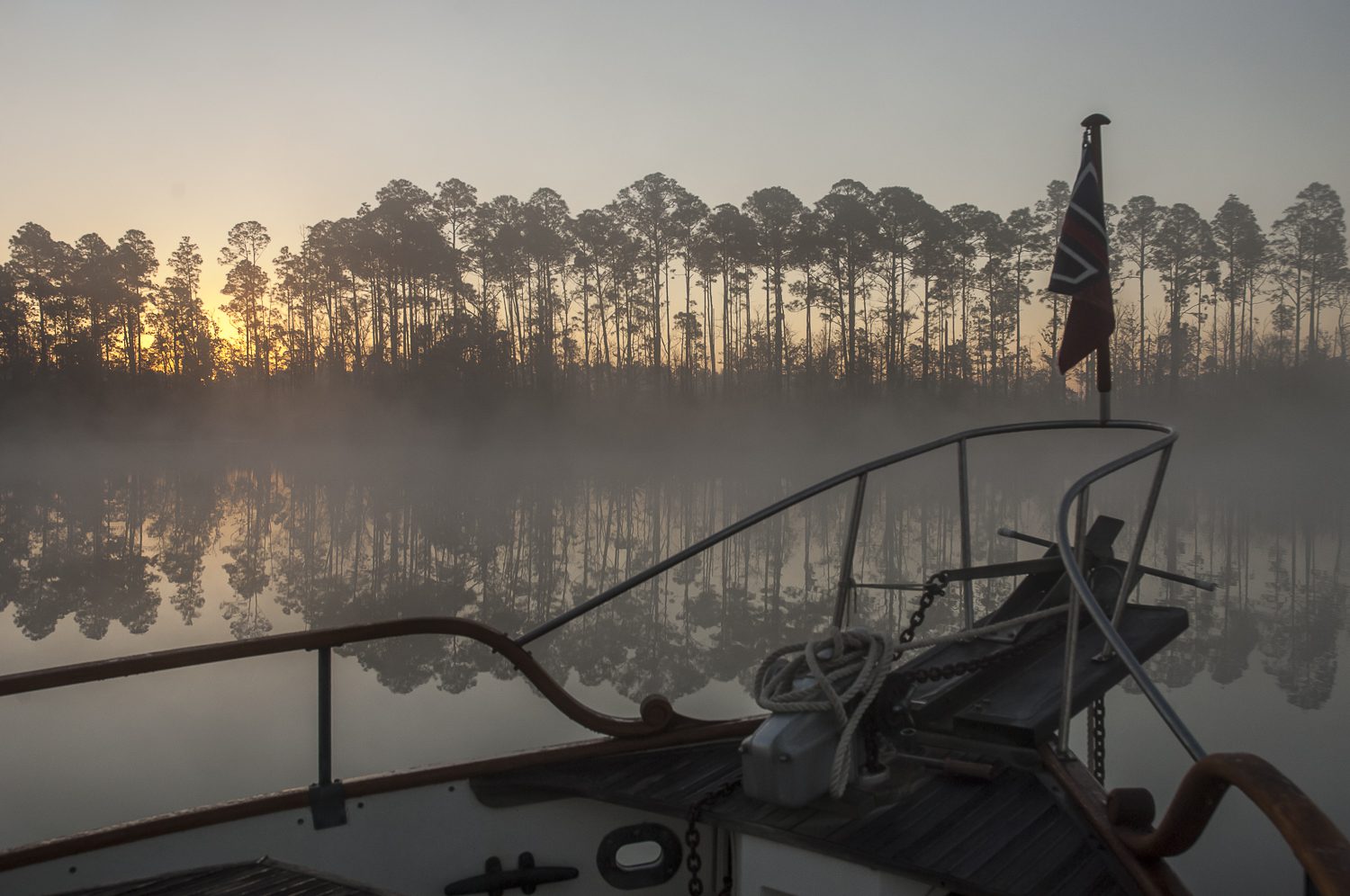
It was a mild and sunny May morning as we rounded Point Lookout in calm winds and flat seas heading up the Potomac River. We’ve passed the wide mouth of the river on many trips up and down Chesapeake Bay, but never ventured up the almost 100 miles to Washington D.C. Intrigued by the river’s history and size. This cruise we wanted to meander up the river and poke into places we hadn’t been and visit the nation’s capital. Cruising your boat up the Potomac River from Chesapeake Bay to Washington DC takes in historic towns, popular DC stops, even the C&O Canal and ghost ships.
Our interest in the Potomac piqued after reading John Page Williams’ CHESAPEAKE Exploring the Water Trail of Captain John Smith. At the ripe old age of 28, Smith and his crew of 14 rowed and sailed their Discovery Barge up these same waters in search of a mythical Northwest Passage to the Pacific. They were hoping to find gold and silver for the Virginia Company, who sponsored their summer explorations of the Chesapeake Bay in 1608 and 1609 from their settlement at Jamestown. Clearly ours were less lofty goals.
The National Water Trail Buoy System
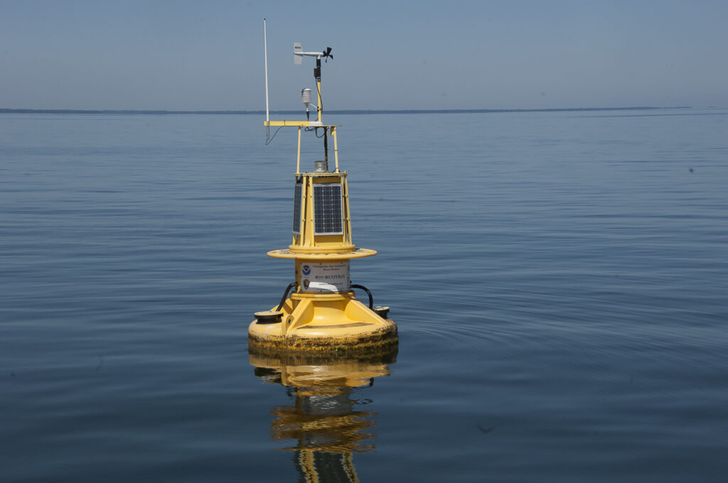
As we rounded the point we looked for the Potomac River Buoy of the National Water Trail, one of six on the Bay. The bright yellow “talking” buoys from NOAA serve as interpretive guideposts for recreational boaters to learn about the diverse heritage and ecosystems of the Bay. There it was bobbing in the water at the coordinates on their website. We called the 800 number posted on the buoy and followed a string of prompts to learn about the history of Smith’s voyage along with sea conditions, and other data and observations. What an innovative way to get information we thought. We’d used a cell phone to learn about restaurants and museum exhibits, but on a boat it seemed far more clever.
St. Mary’s City, a college town and historic treasure

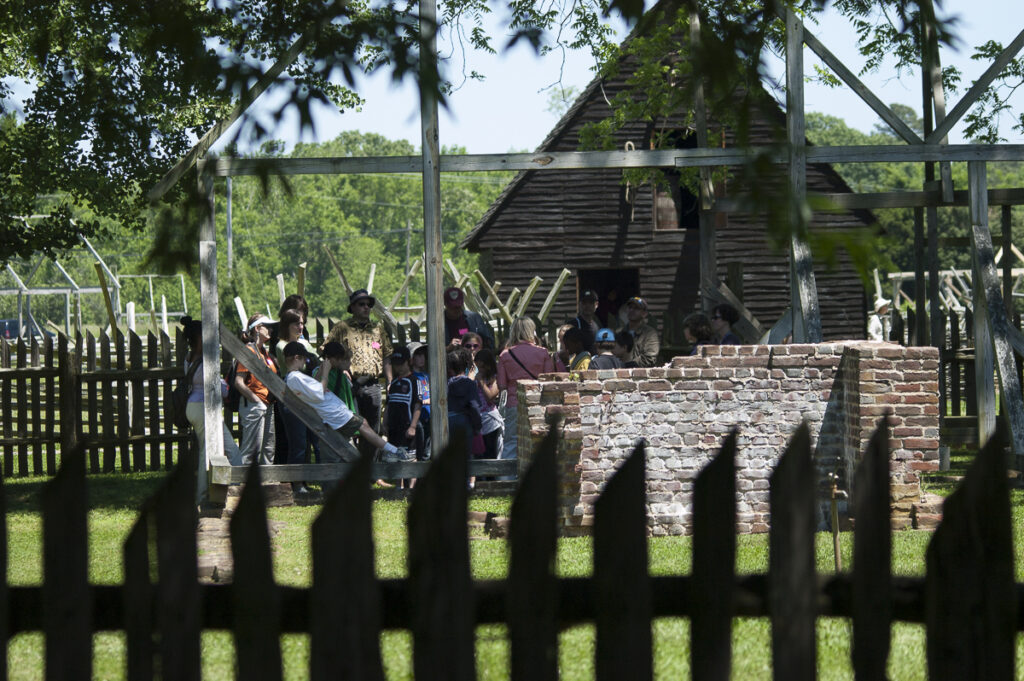
While several watermen worked their lines of colorful crab pots we wove our way through the field making our way to the mouth of St. Mary’s River to anchor at Horseshoe Bend for the night. Since it was early in the season the hospitality dock (2 hours) at St. Mary’s College was open so we tied up and went ashore to explore Historic St. Mary’s City, an outdoor living history museum preserved as a 17th century archaeological site. Just a short walk up the road from the college we entered the site and roamed through the streets of the busy first capital of Maryland. Along the way we saw “ghost frames” or wooden outlines of buildings at their original locations. The stark frames conveyed a sense of size and scale of the structures and community of this early American settlement. As we strolled by Smith’s Ordinary a group of 3rd graders listened to an interpreter explain that an Ordinary was lodging for ordinary people, not the “high born gentlemen” of the settlement.
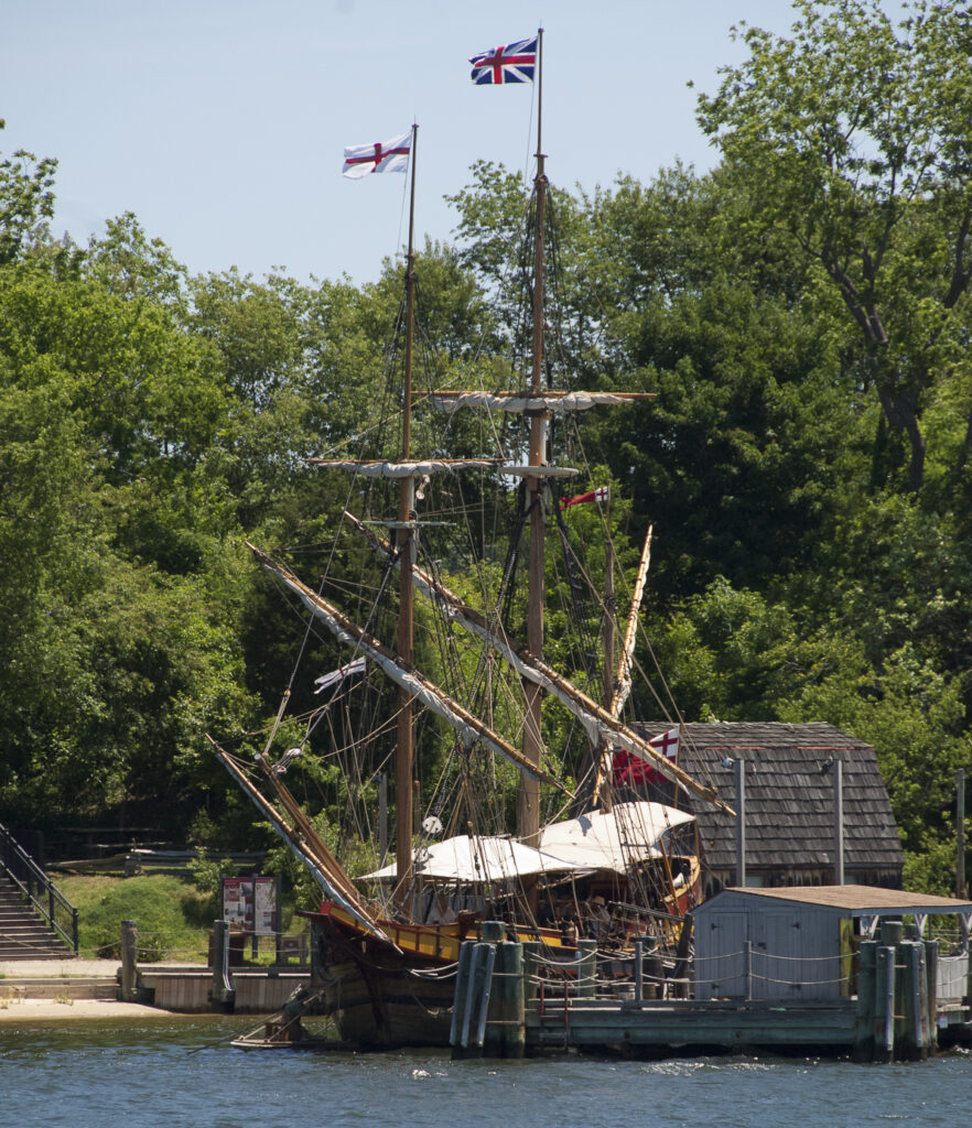
We had passed the Maryland Dove, a recreation of a 17th century square rigged ship earlier as we came up the river. We followed a path down the high bluff to the river with a flock of kids who learned about the working ship and its seagoing days.
While the historic city was busy with field trips, college classes had ended so only a few students were on campus sailing, sunbathing or sitting under a tree with laptops. We took advantage of the college WIFI and got email while an interpreter explained how early settlers churned butter and used bows and arrows to hunt. We marveled at the contrast in our lives today and those of the early colonists.
Later while at anchor in the bucolic harbor we saw a straight white rocket plume shoot into the sky to the east. Earlier that morning the news reported an Air Force satellite would launch from Wallops Island on Virginia’s Atlantic coast. And there is was. Seeing this white streak in the sky brought back memories of the winter of ‘86 when we were aboard in Fort Myers and looked up and saw the forked trail left after the tragic Challenger explosion. You could see that sad sight all the way across the state of Florida.
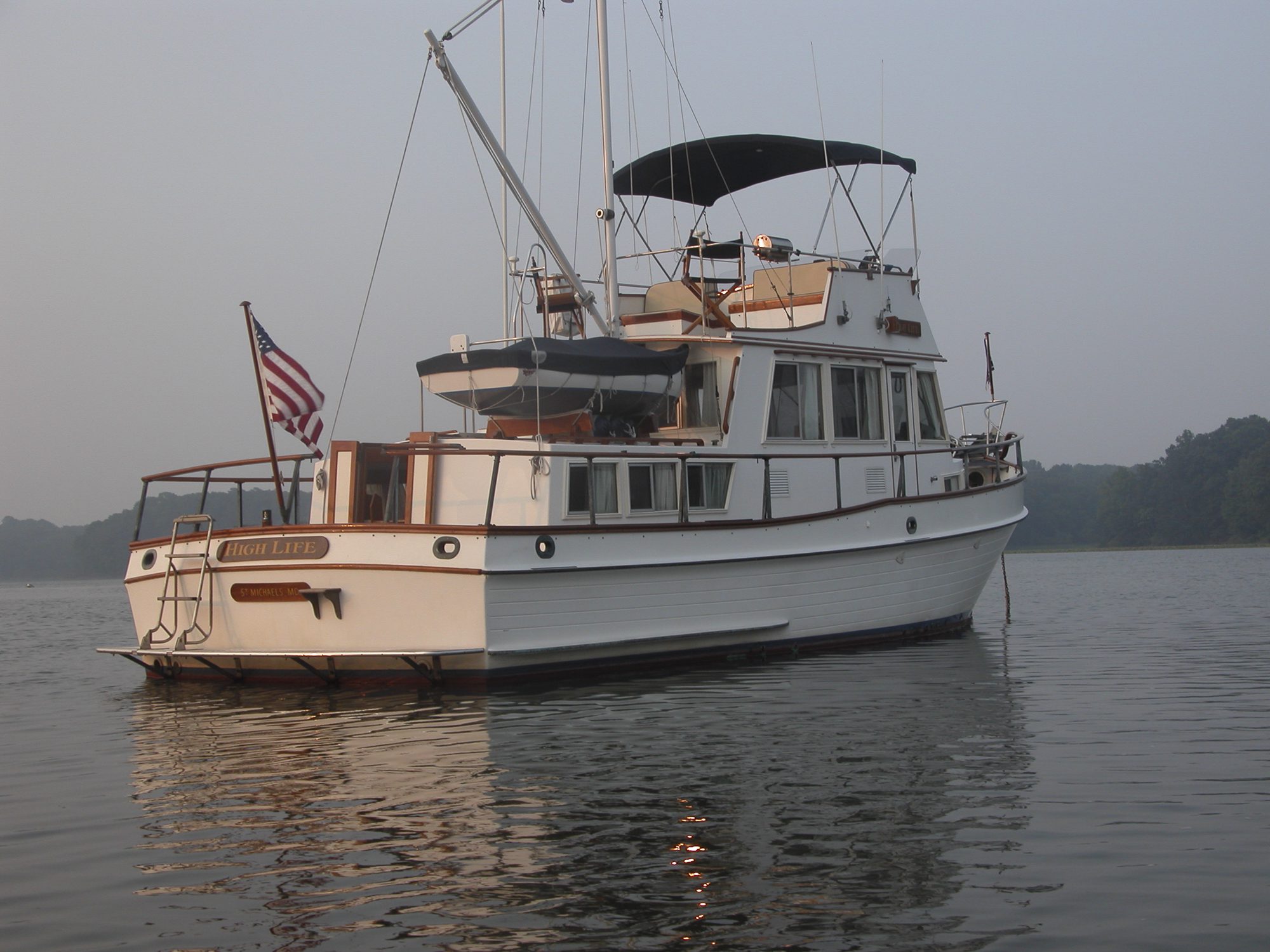
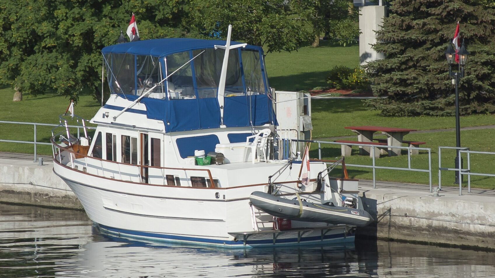
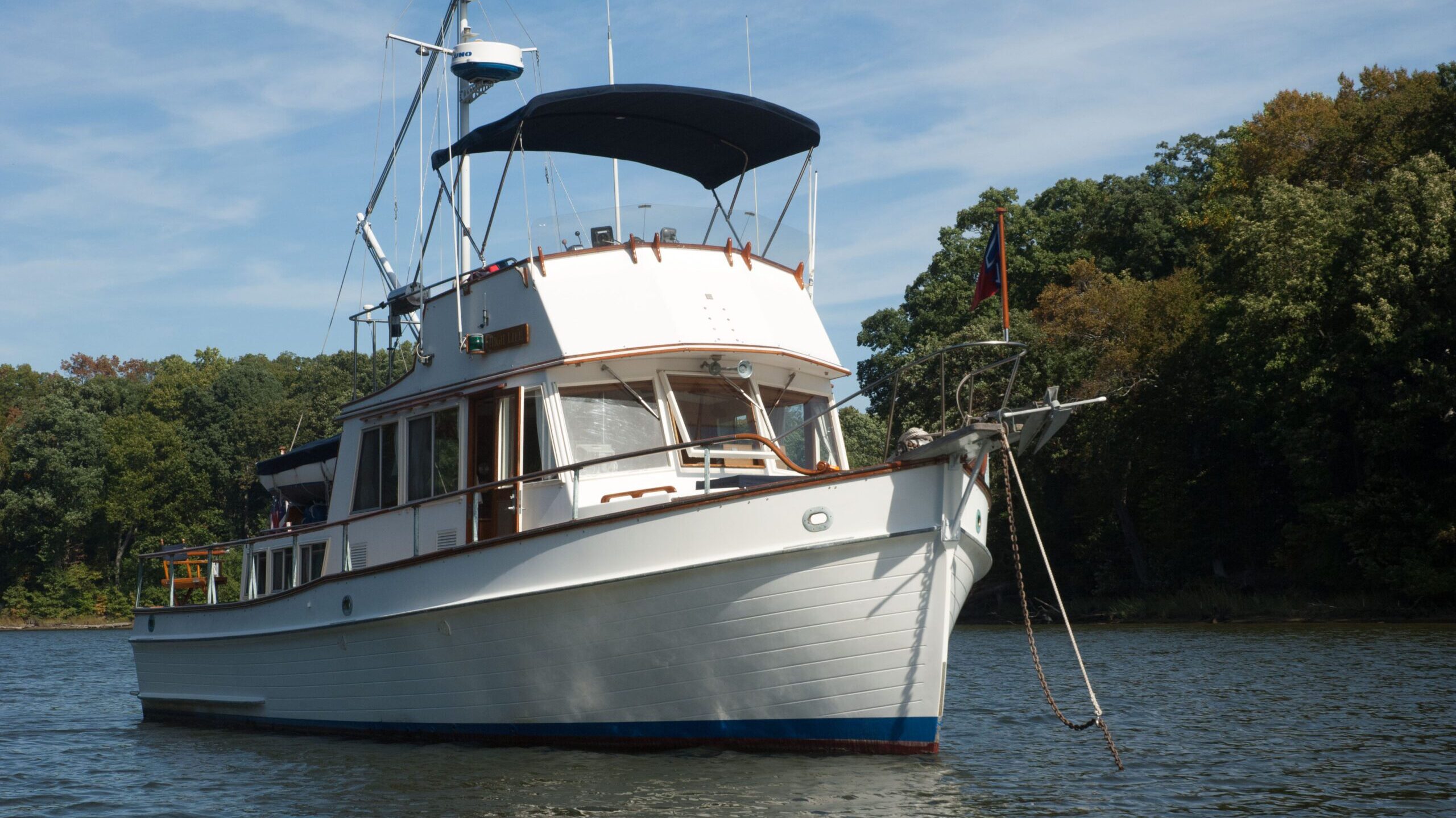
Setting out the next day to the Virginia side of the wide lower Potomac we saw the mouth of the Yeocomico River across the river. We headed further upriver until we found Nomini Bay. The channel was well marked so we wound our way into the creek of the same name to drop the hook where the Nomini Indian Chief and his people shared a feast with John Smith and his crew. While we had the creature comforts of home on High Life, our 36-foot trawler, it was hard to imagine the living conditions and exposure in Smith’s 30-foot open boat.
TIP Our firsthand experience using binoculars on a boat: Binoculars are vulnerable on a boat. An unexpected roll from a passing boat wake can send binocs onto a hard deck surface or worse, bouncing off the boat. To protect binoculars, stow them near the helm so they’re readily available but tucked in a safe cubby that prevents them from being damaged.
Going upriver the next day we noticed the shore of Maryland was dense with forest while the Virginia shore on the lower Potomac was high and broad shouldered with houses perched on top of them.
Golf-carting around Colonial Beach VA
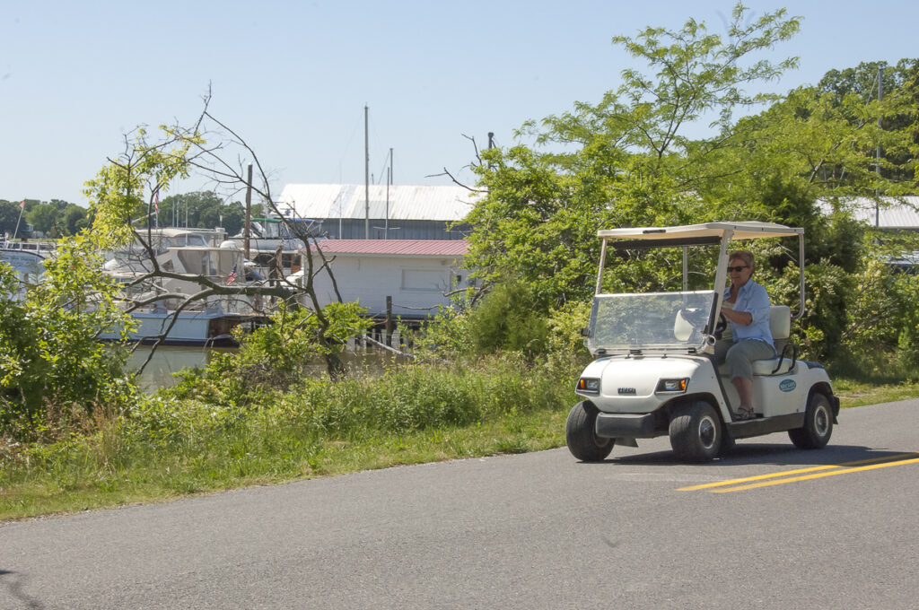
We stopped to visit Colonial Beach, a nice protected harbor known in early days for its oyster wars with Maryland watermen, and later as a gambling haven. The town, a peninsula surrounded by the Potomac on one side and Monroe harbor on the other, was a summer beach resort. Today it’s a golf cart town with marinas and charming cottages on tree-lined streets. A local told us the town’s population grew with full-time residents after World War II when a government munitions plant was built nearby. We spent an afternoon bopping around in a golf cart learning the intricacies of driving on the road with car traffic, quite a change from the controlled paths of a golf course. We felt fortunate for warm weather and cloudless skies, a real break from the rainy Spring we’d had.
As we cruised up the Potomac we fought a pesky tide and current most of the way, but navigating the well-marked river was easy. Gene found that we could pick up a ½ knot or so by hugging the shore and keeping out of the deeper faster moving water. We passed the Naval Proving Grounds on the Virginia shore and went under the Highway 301 bridge. The river takes a sharp turn to port after the bridge and Port Tobacco, a popular anchorage. Then it dips down and heads almost straight north running wide and deep. We passed Aquia Creek to port where Smith and Company went exploring with some Patawomeck Indian scouts in search of a suspected silver mine. A worthless metal was what they found.
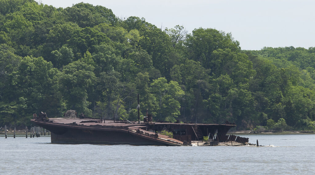
Ghost Ships at Mallows Bay
On the Maryland shore about 30 miles from Washington sat a rusty wreck guarding the fleet of “ghost ships” sunk at the bottom of Mallows Bay, a dumping ground for old war steamships and other derelict vessels. The site, considered to be the largest shipwreck fleet in the Western Hemisphere, has its positive side, having created a giant artificial reef, a habitat reclaimed as a nesting place for birds, fauna and fowl.
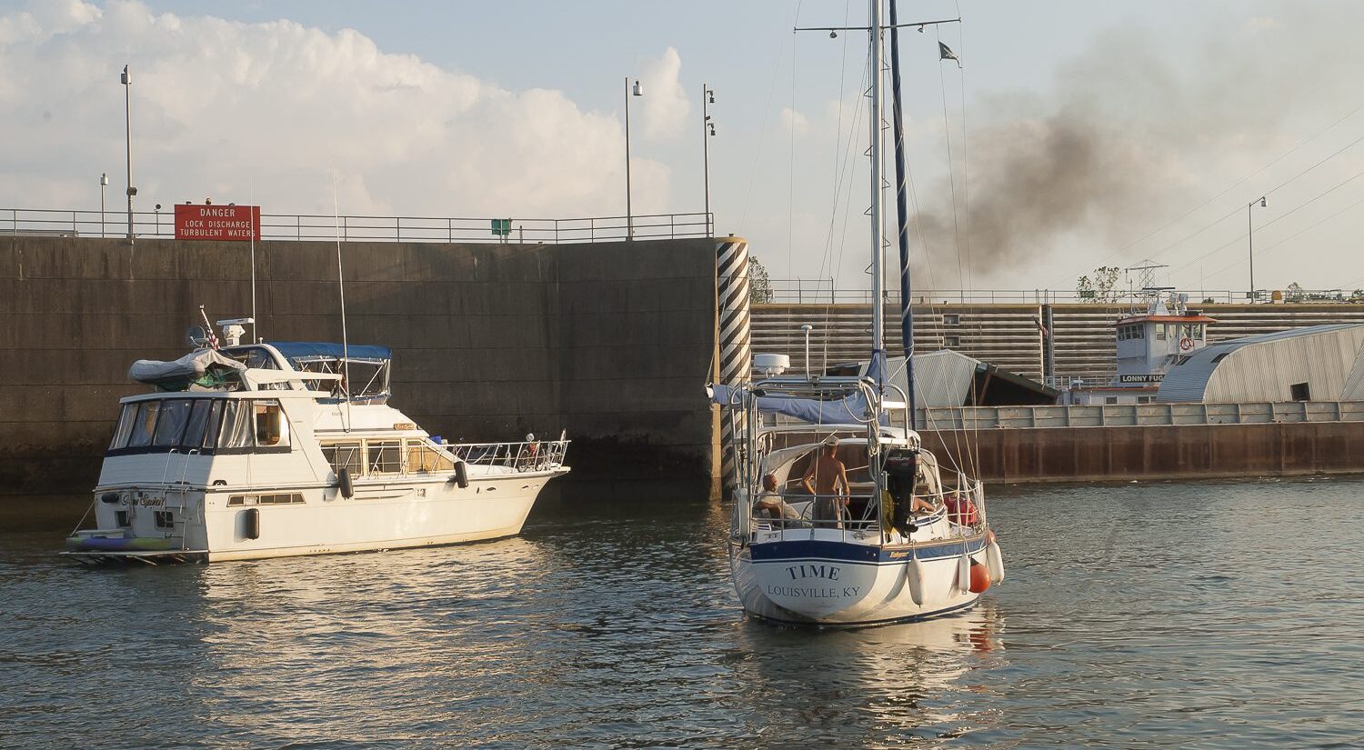
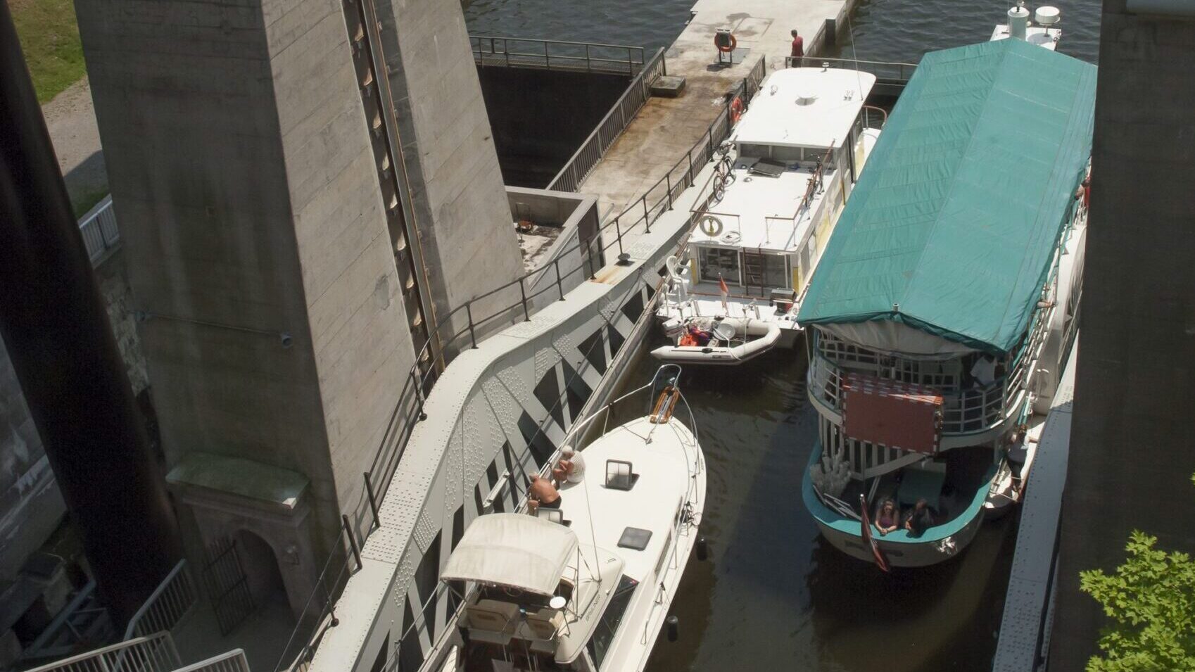
The river narrows as it pushes north beyond Quantico Marine Corp Base where we encountered our first sights and sounds of civilization, most notably helicopters and airplane traffic. Soon after the river narrowed we saw the impressive Wilson Bridge with its upside down white triangular base and roadway straight ahead.
Helicopters and airplanes overhead and boat traffic on the water
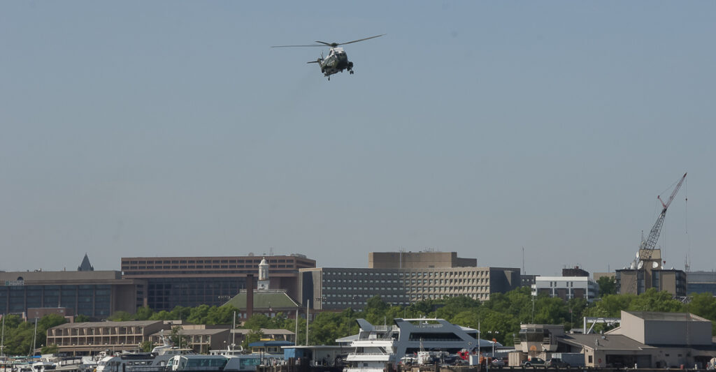
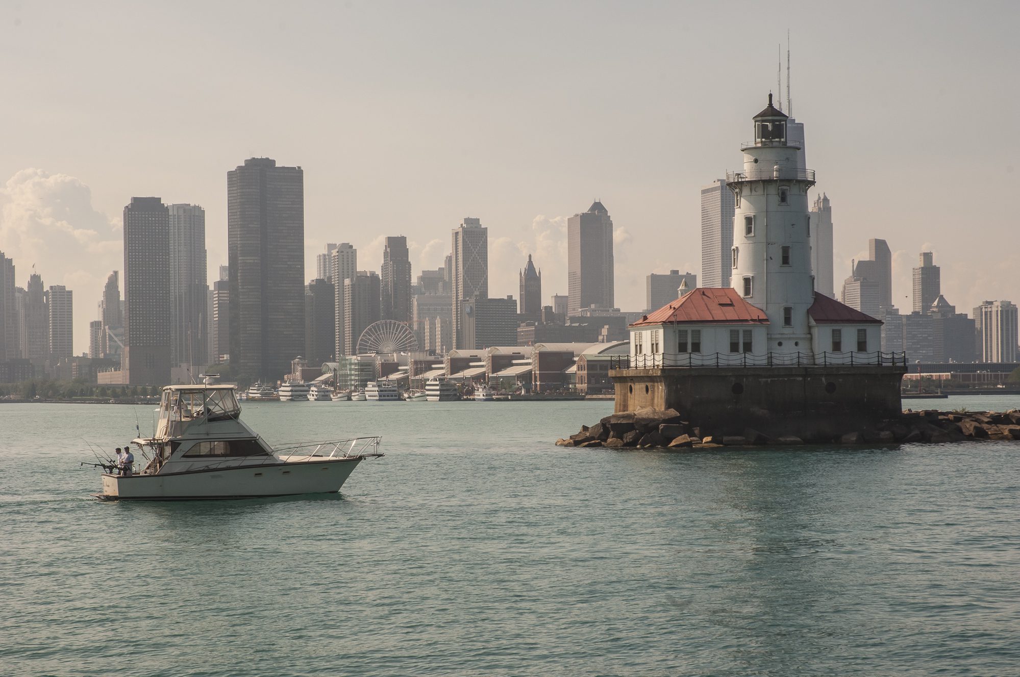
It was the Friday afternoon of Memorial Day weekend as we passed under the bridge and entered the maelstrom of Alexandria tour boat traffic. A no wake zone kept the commotion in check as we studied the chart looking for markers to lead us to the Washington Channel for our stay at the Gangplank marina. We were wide-eyed tourists looking at the steady stream of airplanes lifting off and landing at Reagan National. And we couldn’t take our eyes off the National Monument dead ahead of us as we made our way to the Anacostia River cutoff where we veered off to the marina channel.
Getting around on the DC circulator bus
We were among the throngs of visitors along with a few thousand bikers participating in the Rolling Thunder festivities so we saw the merit of traveling sans auto. We used the DC Circulator, a bus service ($1 a ride, 50 cents for seniors) that along with the Metro, took us everywhere we wanted to go.
We visited some of the Smithsonian museums and were enchanted with Maya Lin’s exhibit at the Corcoran. The artist famous for the Viet Nam Memorial had created large-scale exhibits combining landscape and geologic phenomena. Our favorite was her Water Line, a view of an underwater landmass suspended by wires from the walls and ceiling so you could walk below it.
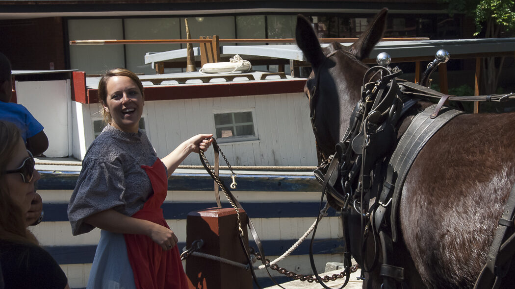
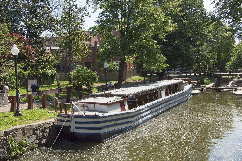
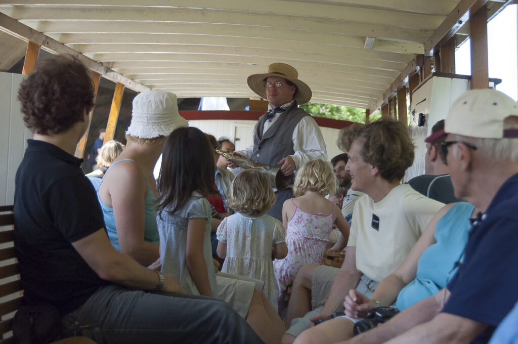
Canaling on the Chesapeake and Ohio Canal in Georgetown
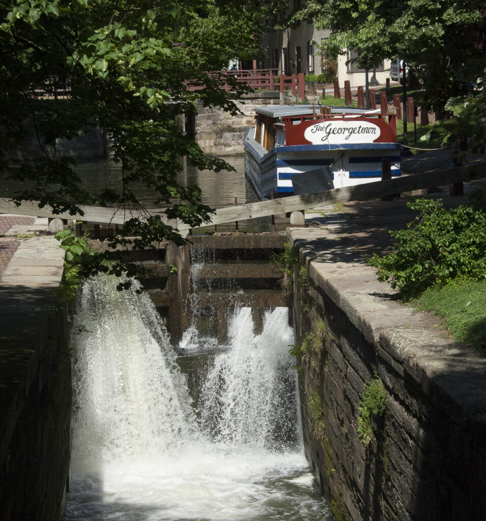
In Georgetown we were part of the casual commotion on M Street enjoying breakfast at an outdoor café with a host of other tourists and locals out for coffee. We took a ride on the Chesapeake and Ohio Canal on a canal barge pulled by mules and led by period-costumed guides from the National Park Service. We’ve been on the Erie and Trans-Severn canals on our own boat but it’s quite different as a passenger on one powered by animals and not a diesel engine.
For a short time in our country’s history canal travel was a main link between major East coast cities only to be replaced by the coal-driven railroads. Ironically it was the canal boats that hauled the coal that fueled them to the train lines.
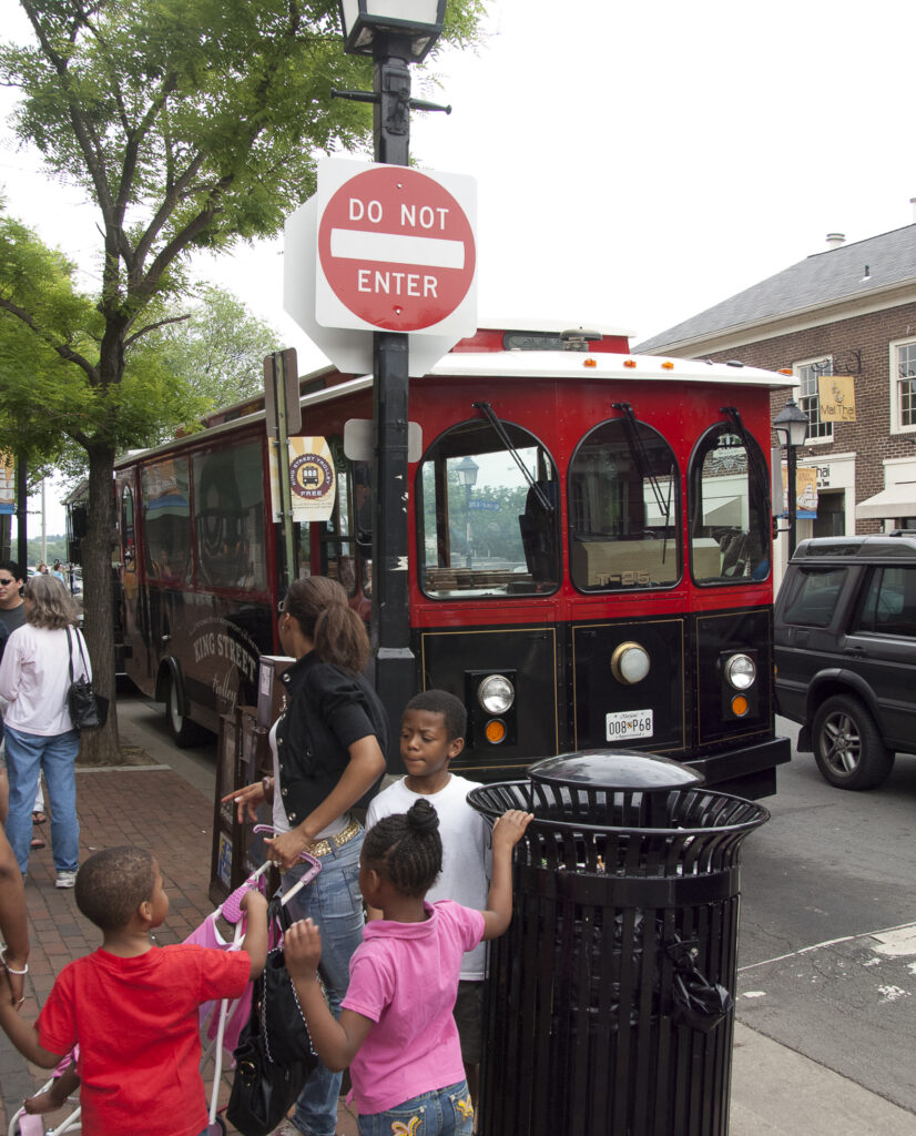
Art and more in Alexandria
It was a short trip by the Circulator bus to the Metro to Alexandria where our plan was to hop on the trolley and ride down King Street to the water. But we arrived at 9:30 a.m. and the trolley didn’t start until later, so we sauntered along King Street, stopped for breakfast, and enjoyed our walk down the main artery of Alexandria with its trendy shops and eateries.
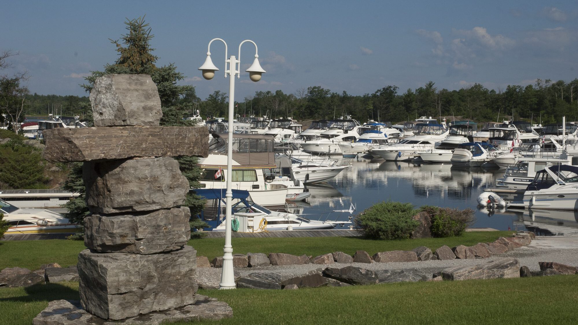
We decided to take the water taxi to take us across the river and check out National Harbor, the massive new complex we passed on the Maryland side of the river near the Wilson Bridge. The lush new marina is based at a large complex of shops and restaurants and a ferris wheel next to the Gaylord National Resort & Convention Center.
After the holiday weekend we slipped our lines early in the morning as many of the liveaboards at the marina were heading to work in the District. The quiet of the morning fog was broken as we passed Reagan National and airplanes soared down the runway followed by a flow of incoming flights. We watched the Metro train we took to Alexandria that runs parallel to the river by the airport until it went underground.
The Capitol District in our wake
For a long time we saw the National Monument in our wake and the impressive George Washington Masonic Memorial on the Alexandria shore. As the day wore on the fog lifted to a haze that led to dark skies on the horizon. The weather forecast had changed and was predicting thunderstorms in the direction we were headed. A tour boat to Mt. Vernon on the Virginia shore passed us with its first load of tourists, but we saw no other commercial traffic on the river. Further south on the Maryland shore we passed Fort Washington, a massive structure that was the only permanent fortification built to defend the river approach to the capital.
Going down river the high bluffs gave way to sandy shores and we enjoyed the slack water; and then got a nice boost from the outgoing tide. If the current and tide had an impact on us, imagine how it helped or hindered Smith and his crew, we wondered. We passed Nanjemoy Creek, another stop on his tour just before the bend in the river. We wondered without help from the Indians would he have been able to create his drawings and observations sketched out in his notebook? By providing the first blueprint of the Chesapeake region he laid the groundwork for many more to come. If not for his encounter with Powhatan, the chief who ruled the tribes of the area and the chief’s 10-year old daughter Pocahontas, who appealed to her father to spare his life, John Smith would probably not even be a footnote in history.
More Bad Weather in the forecast
We watched thunderheads and threatening clouds surround us and instead of going further south we decided to duck back into the safe confines of Colonial Beach Yachting Center. They had plenty of rain but the wind didn’t kick up as predicted. But another front was expected the next day so we thought we’d leave early and duck into Smith Creek near Point Lookout at the mouth of the Bay before the weather changed.
The front arrived early and by 10:30 am dark clouds filled the sky and 30 knots of an east wind wouldn’t let up. As we approached Piney Point we were headed into the mouth of the river and exposed to the Bay banging into 4-foot square waves. We noticed a freighter at anchor at the south end of St. George Island, which we assumed came off the Bay for a bit more protection to wait out the blow.
Returning to St. Mary’s River for refuge
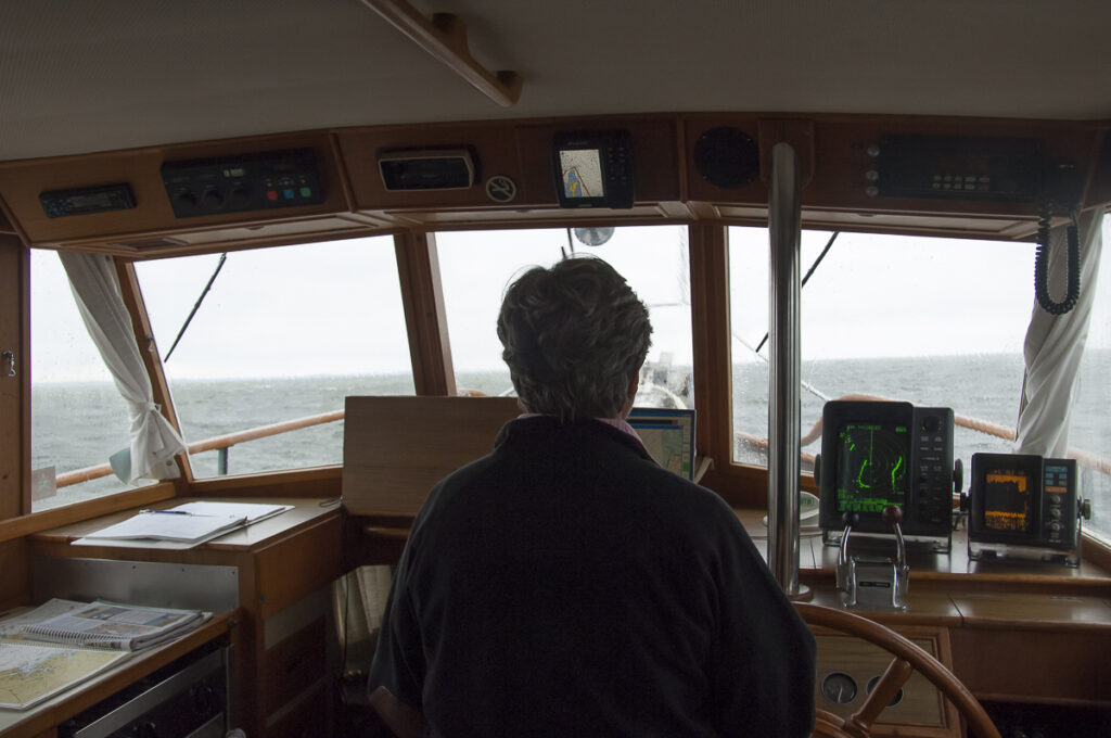
As we reached the mouth of the St. Mary’s River the opposing forces of wind and current made for a most uncomfortable ride. We were running from down below in the main salon. Our Grand Banks 36 is a wet boat in a choppy head sea since she doesn’t have much flair at the bow so torrents of wind driven spray constantly filled our windshield and made seeing and dodging the crab pots a challenge.
We made a quick decision to head into the wide mouth of the familiar St. Mary’s and duck into Indigoes Creek instead of going further down river to the unknown and narrower Smith Creek. The wind and seas were from the East so instead of turning into the St. Mary’s at the first opportunity, we plowed ahead into the seas until we were almost past the entrance. Then we made a 120-degree turn back toward the river to put the seas on our rear quarter. From then on it was all down hill.
We followed a large sailboat into the creek past the Coast Guard station and found a wide open spot to drop the hook to wait out the weather. The holding was good and our anchor set right away against the constant 25 to 30 knot winds. The nice thing about anchoring early in a blow is you can be sure the anchor is holding during the day so the sound of the wind wasn’t too much of a concern that night. Surprisingly we were in a WIFI hotspot and enjoyed an Internet connection thanks to a shoreline homeowners who left their wireless connection open. The only casualty was our shredded Miles River Yacht Club burgee.
As we left the Potomac River the next day a thick fog burned off by mid-morning and the seas were down to a foot or less. We were uncomfortable for a few hours the day before, but we wondered how would Smith and his crew survive in such a small boat in such high winds? He went on to explore and document his findings with drawings and observations of the Bay rivers. And we like to think we’ll followed in his wake, but in a more comfortable boat.
- Visit the Renovated Smithsonian National Air and Space Museum
- Discover Washington DC, Our Nation’s Capital City
- Legs of the Great Loop Cruise
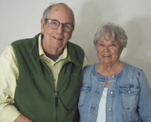
Gene and Katie Hamilton are veteran sail and power boaters and award winning boating writers. They are authors of Coastal Cruising Under Power and Practical Boating Skills. They are members of the Outdoor Writers Association of America.
 |